Delivered either online or in person, these instructor-led live Geographic Information System (GIS) training courses utilize interactive hands-on exercises to demonstrate how to effectively capture, store, manipulate, analyze, manage, and present spatial or geographic data using GIS tools.
Our GIS training is offered in two modes: "online live training" or "onsite live training". Online live training (also known as "remote live training") is conducted through an interactive remote desktop. For those preferring in-person instruction, onsite live training can be hosted locally at client facilities in Gaia or at NobleProg’s corporate training centers in Gaia.
NobleProg -- Your Local Training Provider
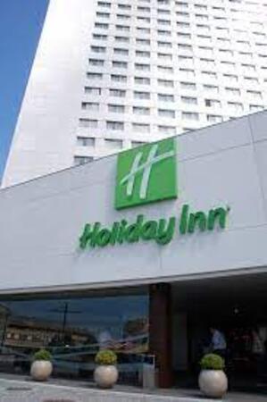
Holiday Inn Porto - Gaia
220, Rua Diogo Macedo, 220, Vila Nova de Gaia 4400-107 , Gaia, Portugal
From Porto by Metro
If you're coming from Porto city centre:
Take the Metro Line D (yellow line) toward Vila d’Este.
Get off at João de Deus.
From João de Deus, walk about 13 minutes to: Rua Diogo Macedo 220, 4400-107 Vila Nova de Gaia.
From Vila Nova de Gaia train station
If by “local train station” you mean Vila Nova de Gaia-Devesas:
The address is approximately 12 minutes walking from Vila Nova de Gaia station according to the accommodation's location information.
You can therefore walk directly rather than taking the metro.
This instructor-led training in Gaia provides intermediate GIS professionals with advanced skills in ArcGIS Pro Plus. Participants will gain proficiency in 3D modelling, spatial data analysis, and Python automation to develop robust geospatial workflows suitable for enterprise environments.
This instructor-led, live training in Gaia (online or onsite) is tailored for GIS professionals and analysts ranging from beginner to advanced proficiency. Participants will learn how to leverage ArcGIS effectively for data visualization, spatial analysis, and the management of geospatial projects.
Upon completion of this training, participants will be equipped to:
Navigate and utilise ArcGIS tools for the management of geospatial data.
Design and customise maps incorporating layers and attributes.
Execute advanced spatial analysis and geoprocessing tasks.
Automate workflows through the use of ModelBuilder and Python.
This instructor-led, live training in Gaia (available online or on-site) is aimed at advanced-level GIS professionals who wish to use ArcGIS Pro to enhance their spatial analysis capabilities, conduct comprehensive geostatistical analysis, and apply advanced 3D modeling techniques for more effective decision-making and problem-solving in real-world scenarios.
By the end of this training, participants will be able to:
Develop advanced skills in spatial analysis techniques using ArcGIS Pro.
Utilize Python scripting for automation and complex data processing.
Apply spatial modeling for problem-solving in real-world scenarios.
Conduct geostatistical analysis for advanced data interpretation.
Integrate external data sources and leverage 3D spatial data analysis.
This instructor-led live training in Gaia (online or onsite) is intended for beginner-level IT support personnel seeking to deliver high-quality support for ArcGIS Enterprise, including the effective resolution of technical faults.
By the end of this training, participants will be able to:
Comprehend the architecture and core components of ArcGIS Enterprise.
Acquire the ability to install, configure, and manage ArcGIS Enterprise.
Develop troubleshooting skills to address common technical issues.
Enhance proficiency in monitoring and maintaining ArcGIS Enterprise ecosystems.
Master essential techniques for backup, recovery, and performance optimization.
This instructor-led, live training in Gaia (online or onsite) is aimed at beginner-level professionals who wish to learn the fundamental concepts and tools of ArcGIS.
By the end of this training, participants will be able to:
Understand the basic concepts of GIS and spatial data.
This instructor-led, live training in Gaia (online or onsite) is designed for beginner-level professionals in earth sciences and engineering who aim to leverage Python for geospatial analysis in ArcGIS and QGIS environments.
Upon completion of this training, participants will be able to:
Master Python syntax and control structures to execute geospatial tasks efficiently.
Apply Pandas, Numpy, and Matplotlib for data analysis and visualization within GIS contexts.
Manipulate and analyze vector data using the Geopandas, Arcpy, and PyQGIS libraries.
Automate geospatial processes and workflows through Python scripting in ArcGIS and QGIS.
Create custom Python-based geoprocessing tools for ArcGIS and QGIS to optimize tasks.
This instructor-led, live training in Gaia (online or onsite) is designed for geographers at an intermediate level who aim to expand their proficiency in spatial analysis, data management, and practical GIS applications.
Upon completion of this training, participants will be capable of:
Employing advanced spatial analysis methods to address intricate geographical challenges.
Overseeing extensive spatial databases and conducting rigorous data quality checks.
Developing dynamic, interactive maps and visualizations for diverse use cases.
Leveraging programming and automation to optimize GIS workflows.
This instructor-led, live training in Gaia (online or onsite) is aimed at field ecologists and conservation managers who wish to create spatial data projects in ArcGIS.
By the end of this training, participants will be able to:
Output spatial data as visualizations.
Conduct geostatistics on actual data.
Implement spatial data analysis, data processing, and mapping with ArcGIS.
In the dynamic energy industry, combining electrical transient analysis with accurate geospatial data has become a critical strategic requirement. At present, depending on disjointed data sources introduces substantial operational risks. This intensive 14-day programme in Melbourne aims to bridge the divide between electrical engineering principles and geospatial management.
In Gaia, this course delivers a thorough introduction to QGIS, encompassing spatial data analysis, map creation, and layer management. It further explores PyQGIS for advanced Python integration and plugin development, thereby equipping participants with practical GIS competencies.
Read more...
Last Updated:
Testimonials (4)
Learning that the QGIS and a tool that can used by other different professionals such land survey
Bame Duncan Koko - Bentel Technologies (Pty) Ltd
Course - QGIS for Geographic Information System
How to use open satellites data for real applications
Tshering Dorji - Druk Holding and Investments
Course - Advanced Geographic Information Systems (GIS)
Hands-on examples allowed us to get an actual feel for how the program works. Good explanations and integration of theoretical concepts and how they relate to practical applications.
Ian - Archeoworks Inc.
Course - ArcGIS Fundamentals
Radomir was very patient and helpful when I got stuck. He was very knowledgeable about the subject matter, and his explanations on different concepts were detailed and thorough.
Rachel Turcan - Animal and Plant Health Agency
Course - ArcGIS for Spatial Analysis
Provisional Upcoming Courses (Contact Us For More Information)
Online GIS training in Gaia, GIS (Geographic Information System) training courses in Gaia, Weekend Geographic Information System courses in Gaia, Evening GIS training in Gaia, GIS instructor-led in Gaia, Evening Geographic Information System courses in Gaia, Geographic Information System coaching in Gaia, GIS (Geographic Information System) private courses in Gaia, Online Geographic Information System training in Gaia, GIS instructor-led in Gaia, Geographic Information System on-site in Gaia, Geographic Information System instructor in Gaia, GIS (Geographic Information System) trainer in Gaia, Geographic Information System boot camp in Gaia, GIS one on one training in Gaia, Weekend GIS training in Gaia, GIS (Geographic Information System) classes in Gaia